
 Tickets
 Parties
 Shop
Shop Directions
#162 March Status Report
March 8, 2021
This month’s report is about another significant feature of the EnterTRAINment Junction (EJ) layout. It’s one whose significance could easily be overlooked. It’s the “live water” feature, which, for most of it, is not very visible from the EJ aisle. It provides such an amazing variety of scenic opportunities, most notably in the Early Period near the towns of River Bend and Canal Town. We’ll follow the flow downstream from its origin to its terminus on the layout
The idea of having a live water feature was part of the EJ planning from the beginning. EJ was conceived by a group of garden railroaders, for whom live water features are very common, so its inclusion in the large-scale EJ layout is easily understandable.
Fortunately, one of the EJ volunteers was in the pool-and-pond business, and so could provide expert guidance on how to implement it on the layout. Water is something whose behavior cannot be scaled well dimensionally. Its surface tension controls droplet sizes, most notable in waterfalls and rapids, and creates that curved fillet that surrounds objects protruding from its surface in still water. These cannot be scaled down usefully, even with additives like surfactants (e,g, soap), which cause even less desirable effects like suds, which are worse for the scale model.
The “unrealistic” appearance of live water has to be tolerated in order to get its other more important benefits. For example: reflections or the ability to dynamically surround and fill gaps around what is immersed in it (like boats) or the ability to fill gaps around the sides of what contains it (like lakes and streams), or the ability to control and even dynamically change its depth. Given all that, EJ’s “Live Water Section Gang” of volunteers has done a superb job producing this amazing feature, which has graced the EJ layout from the very beginning.
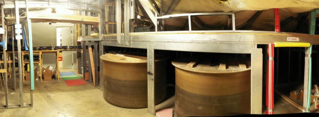
Hidden underneath the layout are two large tanks (Figure 1), capable of holding all of the water in the feature, which is drained into them from the layout at the end of each operating day. For a sense of scale, the doorway at the left is standard height. It leads into the maintenance room that’s under the mezzanine. The opening at the right is a partial height duck-under leading to other parts of the layout
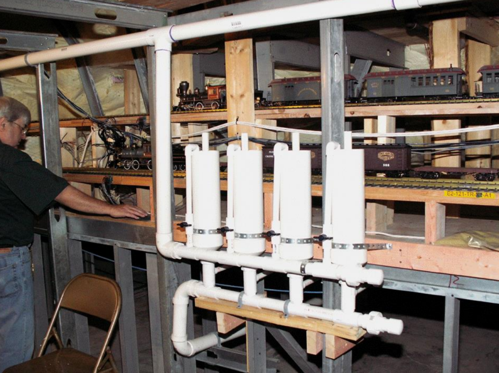
Four adjustable controllers (Figure 2) are used to control the depth of the water, when flowing, at various location on the layout. Water flows in from the pipe at the top through individual valves into the top of each of the cylinders, which inside have an overflow set at the desired depth on the layout to drain out any water that’s above the set level.
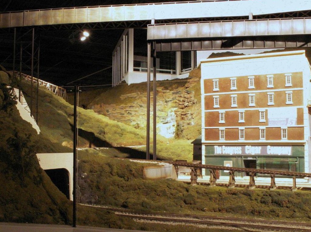
Primary water flow enters the layout at the top of the waterfall (Figure 3) in the alcove on the mezzanine wall facing the Civil War Camp. It falls over several steps, finally exiting as a river flowing away from the mezzanine (at the right of Figure 3).

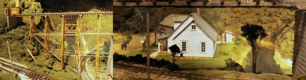
The waterfall is best seen from the mezzanine, but elsewhere, it is not easy to see from the EJ aisle. The only place to see most of its height is just past the aisle tunnel that leads from the Early Period to the Middle Period (Figure 4).
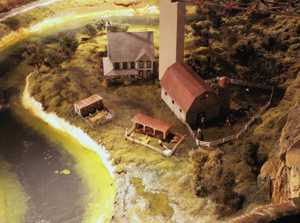
The river that originates at the waterfall (lower right of Figure 5) flows through the Middle Period farm scenes, which are visible only from the mezzanine. It exits the Middle Period (upper right in Figure 5) through a gap in the ridgeline, entering at the left of Civil War Camp area in the Early Period region of the layout. (the left part of Figure 6)
It then flows, mostly unseen, behind the tents of the Civil War Camp, and emerges at the right of the area, flowing toward the EJ aisle behind the Mapleleaf Tavern. (right part of Figure 6)
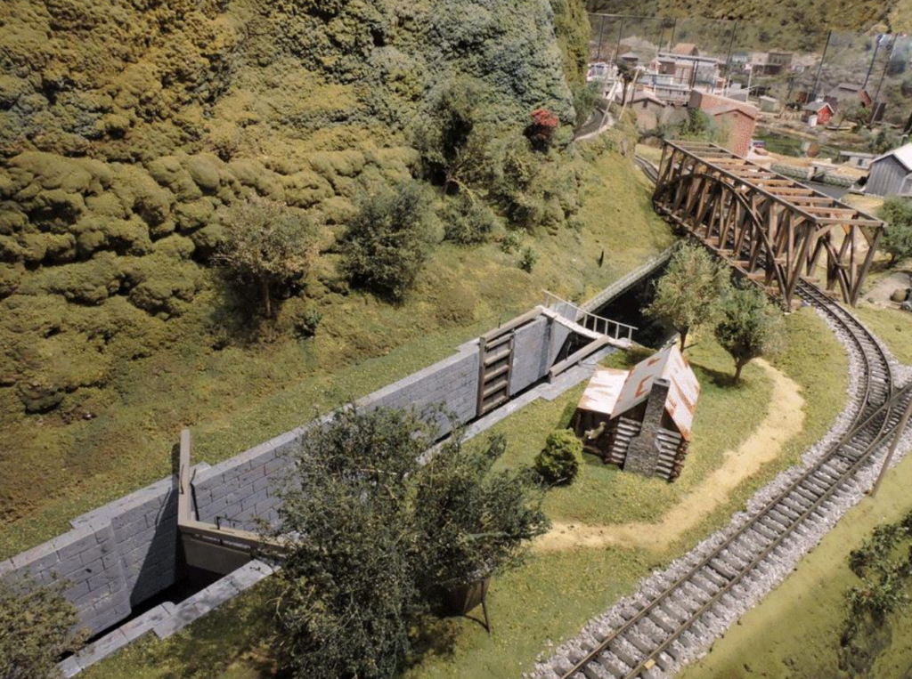
Page BreakFrom there, the river splits. The right branch connects to the canal (Figure 7), whose water follows a direct path through the canal past Canal Town and into the lake at River Bend.
The left, and main, branch of the river flows behind the ridgeline and reappears behind the Early Period’s iron works (right part of Figure 8), flowing right to left, as the viewer sees it, through another gap in the ridgeline (left part of Figure 8).
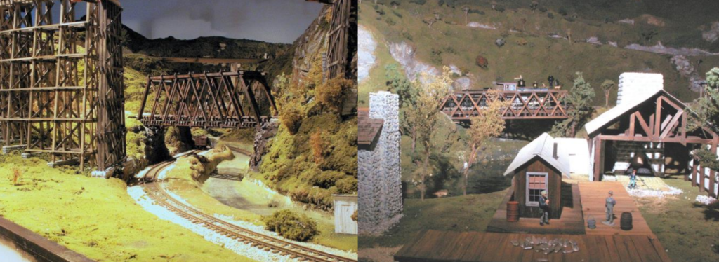
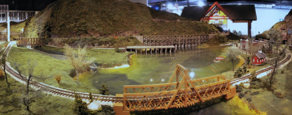
Now the river enters its glory, as it flows out of the gap (at the right of Figure 9), through some rapids, and into the lake at River Bend. This justifies all of the grand scenic elements such a water-side town and such a lake can present.
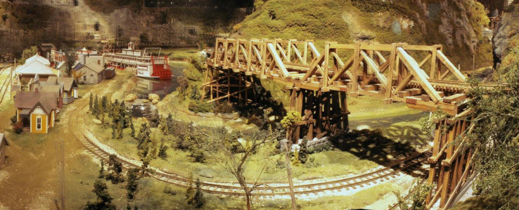
Figure 10 dates back to July of 2008, just before EJ’s opening day. This was before most of the embellishments that make the scene what it is now, over twelve years later (like the paddle-wheel riverboat and the drawbridge, addressed in the two previous articles in this series). Note the canal at the left and the green meadow, which is now the location of Canal Town. The level area just to the left of the dock at the center now has the warehouse with the side-wheel steamer docked by it. The early version of the town of River Bend is visible at the far right. The flow terminates at a drain under the near bridge.
As complicated and maintenance-heavy as the water feature is, its scenic benefits have made it well worth it for the modeling opportunities it provides. Great advantage has been taken of many of those opportunities. Come and see for yourselves all that this live water feature has done for the EJ layout.
©2021 Tom Bartsch
MVGRS Big Train Project Coordinator